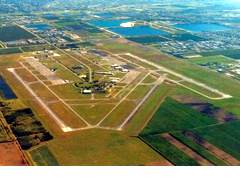
Miami International Airport KMIA
Specs From Air NAV Com
FAA Identifier
Lat/Long:
25-47-35.7000N / 080-17-26.0000W
25-47.595000N / 080-17.433333W
25.7932500 / -80.2905556
(estimated)
Elevation:
8 ft. / 2.4 m (surveyed)
Variation:  05W (2000)
From city:
8 miles NW of MIAMI, FL
Zip code:  33122
Airport Operations
Airport use:
Open to the public
Sectional chart:  MIAMI
Control tower:  yes
ARTCC:  Miami Center
FSS:
Miami Flight Service Station
[1-866-347-0316]
NOTAMs facility:
MIA (NOTAM-D service available)
Attendance:  CONTINUOUS
Wind indicator:  lighted
Segmented circle:  no
Lights:  DUSK-DAWN
Beacon:
white-green (lighted land airport)
Landing fee:  yes
International operations:
international airport of entry
Airport Communications
UNICOM:  123.0
ATIS:  119.15
WX ASOS:
PHONE 305-870-0235
MIAMI GROUND:
121.8(9L/27R/12)
127.5(9R/27L/30) 348.6
MIAMI TOWER:
118.3(270-089)
123.9(090-269) 256.9
MIAMI APPROACH:
120.5(090-269)
124.85(270-089)
322.3(270-089)
379.9(090-269)
125.75 263.025(270-089)
MIAMI DEPARTURE:
119.45(270-089)
120.5(090-269)
124.85(270-089)
125.5(090-269)
290.325(270-089)
354.1(090-269)
379.9(090-269)
CLEARANCE DELIVERY: 135.35 120.35
CLASS B:
120.5(090-269)
379.9(090-269)
CLASS B IC:
124.85(270-089)
322.3(270-089)
EMERG:  121.5
IC:
118.3(270-089)
121.8(9L/27R/12)
127.5(9R/27L/30)
135.35 256.9 348.6
RTIS(120-300 WITHIN 25 NM):  125.25
ASR-4 LCTD AT
LAT 25-47-52.05N LONG 080-17-26.28W
ASR ELEV 7 FT. MTI 25-49-30.2013N
080-19-08.4484W CPME 1: 25-49-30.1783N
080-19-08.4735W CPME 2: 25-47-51.3917N
080-16-09.8710W
Nearby radio navigation aids
VOR radial/distance
DHPr101/3.2
DOLPHIN VORTAC  113.90  04W
VKZr293/7.8
VIRGINIA KEY VOR/DME  117.10  04W
FLLr204/18.5
FORT LAUDERDALE VOR/DME  114.40  00E
PMPr203/(29.0)
POMPANO BEACH VOR  108.80  03W
NDB name
Hdg/Dist    Freq    Var    ID
PLANTATION  194/20.7  242  03W  PJN
Airport Services
Fuel available:  100 JET-A
Parking:  hangars and tiedowns
Airframe service:  MAJOR
Powerplant service:  MAJOR
Bottled oxygen:  HIGH/LOW
Bulk oxygen:  HIGH/LOW


Runway 9/27


Dimensions:
13000 x 150 ft. / 3962 x 46 m
Surface:
asphalt/grooved, in good condition
Weight limitations:
Single wheel:  130000 lbs
Double wheel:  210000 lbs
Double tandem:  420000 lbs
Dual double tandem:  850000 lbs
Latitude:
25-47.165750N  25-47.263845N
Longitude:
080-18.888948W  080-16.520960W
Elevation:  7.2 ft.  8.2 ft.
Traffic pattern:  right  left
Runway heading:
092 magnetic, 087 true
272 magnetic, 267 true
Displaced threshold:  1350 ft.  1270 ft.
Markings:
precision, in good condition
Visual slope indicator:
4-light PAPI on left
(3.00 degrees glide path)
4-box VASI on left
(3.00 degrees glide path)
RVR equipment:
midfield  touchdown, midfield
Approach lights:
MALSR:
1,400 foot medium intensity
approach lighting system with
runway alignment indicator
lights
Centerline lights:  yes
Touchdown point:  yes, no lights
Instrument approach:  ILS  ILS
Obstructions:
23 ft. rr, 750 ft. from runway,
580 ft. right of centerline,
23:1 slope to clear
APCH RATIO 50:1 TO DSPLCD THR.  none


Runway 8R/26L


Dimensions:
10506 x 200 ft. / 3202 x 61 m
Surface:
asphalt/grooved, in good condition
Weight limitations:
Single wheel:  130000 lbs
Double wheel:  210000 lbs
Double tandem:  420000 lbs
Dual double tandem:  850000 lbs
Latitude:
25-48.041948N  25-48.121047N
Longitude:
080-18.085898W  080-16.172095W
Elevation:  7.8 ft.  8.1 ft.
Traffic pattern:  left  right
Runway heading:
092 magnetic, 087 true
272 magnetic, 267 true
Markings:
precision, in good condition
Visual slope indicator:
4-box VASI on left
(3.00 degrees glide path)
4-light PAPI on left
(3.00 degrees glide path)
RVR equipment:  touchdown  touchdown
Approach lights:
MALSR: 1,400 foot medium intensity
approach lighting system with
runway alignment indicator
lights
Centerline lights:  yes  yes
Touchdown point:  yes, lighted
Instrument approach:  ILS/DME  ILS/DME


Runway 12/30


Dimensions:
9354 x 150 ft. / 2851 x 46 m
Surface:
asphalt/grooved, in good condition
Weight limitations:
Single wheel:  130000 lbs
Double wheel:  210000 lbs
Double tandem:  420000 lbs
Dual double tandem:  850000 lbs
Runway edge lights: high intensity
Operational restrictions:
CLSD 2200-0700 WHEN RYS 09L/27R
& 09R/27L ARE IN USE.
Latitude:
25-47.957095N  25-47.197548N
Longitude:
080-18.137427W  080-16.652325W
Elevation:  8.4 ft.  7.8 ft.
Traffic pattern:  left  left
Runway heading:
124 magnetic, 119 true
304 magnetic, 299 true
Displaced threshold:  no  939 ft.
Markings:
precision, in good condition
Visual slope indicator:
4-light PAPI on left
(3.00 degrees glide path)
4-light PAPI on left
Approach lights:
MALSR:
1,400 foot medium intensity approach
lighting system with runway alignment
indicator lights
Centerline lights:  yes  yes
Touchdown point:  yes, no lights
Instrument approach:  ILS/DME  LOC/DME
Obstructions:
40 ft. tower, 1700 ft. from runway, 200 ft.
left of centerline, 37:1 slope to clear
52 ft. tree, 1600 ft. from runway, 300 ft.
left of centerline, 26:1 slope to clear
APCH RATIO 48:1 TO DSPLCD THR.
+20' RR 200' FM RY END; 450'L.


Runway 8L/26R


Dimensions:
8600 x 150 ft. / 2621 x 46 m
Surface:
asphalt/grooved, in good condition
Weight limitations:
Single wheel:  130000 lbs
Double wheel:  210000 lbs
Double tandem:  420000 lbs
Dual double tandem:  850000 lbs
Latitude:
25-48.173887N  25-48.238755N
Longitude:
080-18.092595W  080-16.525822W
Elevation:  8.3 ft.  8.3 ft.
Traffic pattern:  left  left
Runway heading:
092 magnetic, 087 true
272 magnetic, 267 true
Visual slope indicator:
4-light PAPI on left
(3.00 degrees glide path)
4-light PAPI on left
(3.00 degrees glide path)
Runway end identifier lights:  yes
Touchdown point:  yes, no lights
Instrument approach:  LOC/DME  LOC/DME

Kendall Tamiami Executive Airport KMIA
Specs From Air NAV Com
FAA Identifier
Lat/Long:
25-38-52.4000N / 080-25-58.0000W
25-38.873333N / 080-25.966667W
25.6478889 / -80.4327778
(estimated)
Elevation:
8 ft. / 2.4 m (surveyed)
Variation:  03W (1985)
From city:
13 miles SW of MIAMI, FL
Zip code:  33186
Airport Operations
Airport use:
Open to the public
Sectional chart:  MIAMI
Control tower:  yes
ARTCC:  MIAMI CENTER
FSS:
Miami Flight Service Station
[1-866-347-0316]
NOTAMs facility:
TMB (NOTAM-D service available)
Attendance:  CONTINUOUS
Pattern altitude:
TPA 1000 FT AGL; HIGH PERFORMANCE
ACFT 1500 FT AGL. HEL TFC PATTERN
RY 09R WITHIN FIXED WING PATTERN
AT OR BLO 490 FT AGL.
Wind indicator:  lighted
Segmented circle:  yes
Lights:  DUSK-DAWN
WHEN ATCT CLSD ACTVT MALSR RY 09R -
CTAF. MIRL RY 13/31 AVBL
THRU REQ FROM MIAMI AFSS - 118.9.
Beacon:  white-green
(lighted land airport)
International operations:
customs landing rights airport
Airport Communications
CTAF:  118.9
ATIS:  124.0
WX ASOS:
PHONE 305-235-1332
TAMIAMI GROUND:
121.7 [0700-2100]
TAMIAMI TOWER:
118.9 134.6 [0700-2100]
MIAMI APPROACH:  125.5
MIAMI DEPARTURE:  125.5
CLEARANCE DELIVERY:  133.0
VFR-ADV:  118.9
Nearby radio navigation aids
VOR radial/distance
DHPr210/10.2
DOLPHIN VORTAC  113.90  04W
VKZr251/16.3
VIRGINIA KEY VOR/DME  117.10  04W
FLLr211/29.7
FORT LAUDERDALE VOR/DME  114.40  00E
NDB name
Hdg/Dist    Freq    Var    ID
PLANTATION  205/31.3  242  03W  PJN
Airport Services
Fuel available:  100LL JET-A
Parking:  hangars and tiedowns
Airframe service:  MAJOR
Powerplant service:  MAJOR
Bottled oxygen:  HIGH/LOW
Bulk oxygen:  LOW


Runway 9L/27R


Dimensions:
5001 x 150 ft. / 1524 x 46 m
Surface:
asphalt, in good condition
Weight limitations:
Single wheel:  65000 lbs
Double wheel:  110000 lbs
Double tandem:  195000 lbs
Runway edge lights:
medium intensity
Operational restrictions:
RY 09L/27R CLSD WHEN ATCT CLSD.
Latitude:
25-39.158133N  25-39.196550N
Longitude:
080-26.404800W  080-25.494950W
Elevation:  7.9 ft.  7.8 ft.
Traffic pattern:  left  left
Runway heading:
090 magnetic, 087 true
270 magnetic, 267 true
Markings:
nonprecision, in good condition
Visual slope indicator:
4-light PAPI on left
(3.00 degrees glide path)
2-light PAPI on left
(3.00 degrees glide path)
Touchdown point:  yes, no lights


Runway 9R/27L


Dimensions:
4999 x 150 ft. / 1524 x 46 m
Surface:  asphalt, in good condition
Weight limitations:
Single wheel:  65000 lbs
Double wheel:  110000 lbs
Double tandem:  195000 lbs
Runway edge lights:  high intensity
Latitude:
25-38.581850N  25-38.620383N
Longitude:
080-26.283700W  080-25.374350W
Elevation:  7.9 ft.  7.9 ft.
Traffic pattern:  left  left
Runway heading:
090 magnetic, 087 true
270 magnetic, 267 true
Markings:
precision, in good condition
Visual slope indicator:
4-box VASI on left
(3.00 degrees glide path)
4-light PAPI on left
(3.00 degrees glide path)
Approach lights:
MALSR:
1,400 foot medium intensity
approach lighting system with
runway alignment indicator lights
Touchdown point:  yes, no lights
Instrument approach:  ILS


Runway 13/31


Dimensions:
4001 x 150 ft. / 1220 x 46 m
Surface:
asphalt, in good condition
Weight limitations:
Single wheel:  65000 lbs
Double wheel:  110000 lbs
Double tandem:  195000 lbs
Runway edge lights:  medium intensity
Latitude:
25-39.034233N  25-38.633533N
Longitude:
080-26.447567W  080-25.868333W
Elevation:  8.0 ft.  8.0 ft.
Traffic pattern:  left  left
Runway heading:
130 magnetic, 127 true
310 magnetic, 307 true
Markings:  basic, in good condition
Touchdown point:  yes, no lights
Obstructions:  none  40 ft. pole,
1300 ft. from runway, 300 ft.
left of centerline, 27:1 slope to clear
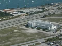
Miami Heliport X46
Specs From Air NAV Com
FAA Identifier
Lat/Long:
25-47-09.8818N / 080-10-38.4717W
25-47.164697N / 080-10.641195W
25.7860783 / -80.1773532
(estimated)
Elevation:
7 ft. / 2 m (estimated)
Variation:  03W (1985)
From city:
1 mile E of MIAMI, FL
Zip code:  33132
Heliport Operations
Heliport use:
Open to the public
Sectional chart:  MIAMI
Control tower:  no
ARTCC:  Miami Center
FSS:
Miami Flight Service Station
[1-866-347-0316]
NOTAMs facility:
MIA (NOTAM-D service available)
Attendance:  UNATNDD
TKOF/LNDNGS MUST OCCUR
BTN THE HRS OF 0600-2000.
Wind indicator:  lighted
Segmented circle:  no
Lights:  DUSK-DAWN
Heliport Communications
CTAF:  123.05
Nearby radio navigation aids
VOR radial/distance
VKZr333/2.4
VIRGINIA KEY VOR/DME  117.10  04W
DHPr099/9.3
DOLPHIN VORTAC  113.90  04W
FLLr184/17.4
FORT LAUDERDALE VOR/DME  114.40  00E
PMPr191/(28.0)
POMPANO BEACH VOR  108.80  03W
NDB name
Hdg/Dist    Freq    Var    ID
PLANTATION  177/20.9  242  03W  PJN
Heliport Services
Parking:  hangars and tiedowns
Airframe service:  MINOR
Powerplant service:  MINOR
Bottled oxygen:  NONE
Bulk oxygen:  NONE


Helipad H1
Dimensions:
80 x 80 ft. / 24 x 24 m
Surface:  turf, in poor condition
Runway edge markings:
HELIPAD MRKD WITH AN H.
Operational restrictions:
ORIENTED DUE NORTH.
Traffic pattern:  left
|

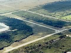
Opa-Locka Airport
14201 N.W. 42 Avenue
Opa-locka, Fl 33054
Tel: (305) 869-1660
Fax: (305) 869-1666
Opa Locka Airport KLCQ
Specs From Air NAV Com
FAA Identifier
Lat/Long:
25-54-25.2000N / 080-16-42.2000W
25-54.420000N / 080-16.703333W
25.9070000 / -80.2783889
(estimated)
Elevation:
8 ft. / 2.4 m (surveyed)
Variation:  02W (1980)
From city:
10 miles N of MIAMI, FL
Zip code:  33014
Airport Operations
Airport use:
Open to the public
Sectional chart:  MIAMI
Control tower:  yes
ARTCC:
Miami Center
FSS:
Miami Flight Service Station
[1-866-347-0316]
NOTAMs facility:
OPF (NOTAM-D service available)
Attendance:  CONTINUOUS
Pattern altitude:  1008 ft. MSL
Wind indicator:  lighted
Segmented circle:  yes
Lights:  DUSK-DAWN
ACTVT MALSR RYS 09L & 12 AND MALS
RY 27R - CTAF. HIRL RY 12/30
PRESET MED INTST WHEN ATCT CLSD.
Beacon:
white-green (lighted land airport)
International operations:
customs landing rights airport
Airport Communications
CTAF:  120.7
ATIS:  125.9
WX ASOS:
PHONE 305-681-4063
OPA LOCKA GROUND:
121.9 336.4 [0700-2100]
OPA LOCKA TOWER:
120.7 360.8 118.6 [0700-2100]
MIAMI APPROACH:
128.6(4000 BLO)
MIAMI DEPARTURE:
128.6(4000 BLO)
CLEARANCE DELIVERY:  119.2
ALL ARRIVING AIRCRAFT ARE REQUESTED
TO INITIALLY CONTACT OPA LOCKA TOWER
ON FREQ 120.7/360.8 FOR APPROPRIATE
RWY ARRIVAL PROCEDURE AND FREQ ASSIGNMENT.
Nearby radio navigation aids
VOR radial/distance
DHPr035/7.5
DOLPHIN VORTAC  113.90  04W
VKZr328/11.5
VIRGINIA KEY VOR/DME  117.10  04W
FLLr214/12.1
FORT LAUDERDALE VOR/DME  114.40  00E
PMPr207/(22.4)
POMPANO BEACH VOR  108.80  03W
NDB name
Hdg/Dist    Freq    Var    ID
PLANTATION  196/13.9  242  03W  PJN
Airport Services
Fuel available:  100LL JET-A
Parking:  hangars and tiedowns
Airframe service:  MAJOR
Powerplant service:  MAJOR
Bottled oxygen:  HIGH/LOW
Bulk oxygen:  HIGH/LOW


Runway 9L/27R


Dimensions:
8002 x 150 ft. / 2439 x 46 m
Surface:
asphalt/grooved, in good condition
Weight limitations:
Single wheel:  96000 lbs
Double wheel:  155000 lbs
Double tandem:  290000 lbs
Runway edge lights:  high intensity
Operational restrictions:
RY 09L/27R CLSD 2100-0700 EXCP
WITH 30 MIN PPR TO ACTVT RY
LGTS CALL 305-8669-1660 OR CTC CTAF.
Latitude:
25-54.758783N  25-54.829300N
Longitude:
080-17.320333W  080-15.861783W
Elevation:  7.2 ft.  7.5 ft.
Traffic pattern:  left  right
Runway heading:
089 magnetic, 087 true
269 magnetic, 267 true
Declared distances:
TORA-8002; TODA-8202;
ASDA-8202; LDA-8002.
TORA-8002; TODA-8202;
ASDA-8202; LDA-8002.
Markings:
precision, in good condition
Visual slope indicator:
4-box VASI on left
(3.00 degrees glide path)
4-box VASI on left
(3.00 degrees glide path)
Approach lights:
MALSR:
1,400 foot medium intensity approach
lighting system with runway alignment
indicator lights
Touchdown point:  yes, no lights
Instrument approach:  ILS  ILS/DME


Runway 12/30


Dimensions:
6800 x 150 ft. / 2073 x 46 m
Surface:
asphalt/grooved, in good condition
Weight limitations:
Single wheel:  96000 lbs
Double wheel:  200000 lbs,
LIMITED BY AMGR TO
155000 LBS DUAL WHEEL GEAR.
Runway edge lights:  high intensity
Gradient:  DATA ESTD.
Latitude:
25-54.636567N  25-54.044433N
Longitude:
080-17.326783W  080-16.272333W
Elevation:  8.2 ft.  8.2 ft.
Traffic pattern:  left  left
Runway heading:
124 magnetic, 122 true
304 magnetic, 302 true
Displaced threshold:  800 ft.  no
Declared distances:
TORA-6800; TODA-7800;
ASDA-7000; LDA-6000.
TORA-6800; TODA-7000;
ASDA-7000; LDA-6800.
Markings:
precision, in good condition
Visual slope indicator:
4-light PAPI on left
(3.00 degrees glide path)
4-light PAPI on left
(3.00 degrees glide path)
Approach lights:
MALSR:
1,400 foot medium intensity approach
lighting system with runway
alignment indicator lights
Touchdown point:  no, no lights
Instrument approach:  ILS/DME


Runway 18/36


Dimensions:
4394 x 100 ft. / 1339 x 30 m
Surface:
asphalt, in fair condition
Weight limitations:
Single wheel:  30000 lbs
Runway edge lights:  medium intensity
Latitude:
25-54.677933N  25-53.952650N
Longitude:
080-16.740550W  080-16.745050W
Elevation:  5.9 ft.  6.1 ft.
Traffic pattern:  left  right
Runway heading:
182 magnetic, 180 true
002 magnetic, 000 true
Declared distances:
TORA-4394; TODA-4394;
ASDA-4394; LDA-4394.
TORA-4394; TODA-4394;
ASDA-5338; LDA-4394.
Markings:
basic, in good condition
Runway end identifier lights:  yes
Touchdown point:
yes, no lights
Obstructions:
none  42 ft. trees, 1280 ft.
from runway, 25:1 slope to clear


Runway 9R/27L


Dimensions:
4306 x 100 ft. / 1312 x 30 m
Surface:
asphalt, in good condition
Weight limitations:
Single wheel:  37000 lbs
Double wheel:  61000 lbs
Runway edge lights:  medium intensity
Latitude:
25-53.942183N  25-53.979950N
Longitude:
080-17.109900W  080-16.325033W
Elevation:  6.1 ft.  6.2 ft.
Traffic pattern:  right  left
Runway heading:
089 magnetic, 087 true
269 magnetic, 267 true
Declared distances:
TORA-4306; TODA-4306;
ASDA-4306; LDA-4306.
TORA-4306; TODA-4306;
ASDA-4306; LDA-4306.
Markings:
basic, in good condition
Visual slope indicator:
4-box VASI on left
(3.00 degrees glide path)
4-light PAPI on left
(3.00 degrees glide path)
Touchdown point:  yes, no lights
Obstructions:
33 ft. poles, 1520 ft. from runway,
300 ft. right of centerline,
40:1 slope to clear  none
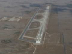
Dade-Collier Training and Transition Airport
KTNT Specs From Air NAV Com
FAA Identifier
Lat/Long:
25-51-42.5000N / 080-53-49.2000W
25-51.708333N / 080-53.820000W
25.8618056 / -80.8970000
(estimated)
Elevation:
13 ft. / 4.0 m (surveyed)
Variation:  05W (2000)
From city:
36 miles W of MIAMI, FL
Zip code:  34141
Airport Operations
Airport use:
ARPT CLSD TO PUBLIC EXCP BY
ARRANGEMENT WITH DADE COUNTY
AVIATION DEPT MIAMI 305-869-1700.
Sectional chart:  MIAMI
Control tower:  no
ARTCC:  MIAMI CENTER
FSS:
Miami Flight Service Station
[1-866-347-0316]
NOTAMs facility:
MIA (NOTAM-D service available)
Attendance:  CONTINUOUS
Wind indicator:  lighted
Segmented circle:  yes
Lights:  DUSK-DAWN
ACTVT HIRL RY 09/27
& SSALS RY 09 -
CTAF OR BY CALLING
239-695-3300.
Beacon:  white-green
(lighted land airport)
Airport Communications
CTAF/UNICOM:  123.0
APCH/DEP SVC PRVDD BY
MIAMI ARTCC ON FREQS
132.4/281.5 (MIAMI RCAG).
Nearby radio navigation aids
VOR radial/distance
DHPr281/29.8
DOLPHIN VORTAC  113.90  04W
Airport Services
Airframe service:  NONE
Powerplant service:  NONE
Bottled oxygen:  NONE
Bulk oxygen:  NONE


Runway 9/27


Dimensions:
10499 x 150 ft. / 3200 x 46 m
Surface:
asphalt/porous friction courses,
in good condition
Weight limitations:
Single wheel:  130000 lbs
Double wheel:  200000 lbs
Double tandem:  400000 lbs
Dual double tandem:  800000 lbs
Runway edge lights:  high intensity
Latitude:
25-51.708200N  25-51.706967N
Longitude:
080-54.777233W  080-52.861733W
Elevation:  12.6 ft.  12.4 ft.
Traffic pattern:  left  right
Runway heading:
095 magnetic, 090 true
275 magnetic, 270 true
Markings:
precision, in fair condition
Visual slope indicator:
4-light PAPI on left
(3.00 degrees glide path)
Approach lights:
SSALS: simplified short
approach lighting system
Touchdown point:  yes, no lights
Instrument approach:  ILS
Opa Locka West Airport X46
Specs From Air NAV Com
FAA Identifier
Lat/Long:
25-56-56.3350N / 080-25-24.1930W
25-56.938917N / 080-25.403217W
25.9489819 / -80.4233869
(estimated)
Elevation:
8 ft. / 2 m (estimated)
Variation:  03W (1985)
From city:
12 miles NW of MIAMI, FL
Zip code:  33029
Airport Operations
Airport use:
Open to the public
Sectional chart:  Miami
Control tower:  no
ARTCC:  Miami Center
FSS:
Miami Flight Service Station
[1-866-347-0316]
NOTAMs facility:
MIA (NOTAM-D service available)
Attendance:  UNATNDD
GROUND ACCESS BY PRIOR REQUEST.
Wind indicator:  yes
Segmented circle:  yes
Airport Communications
CTAF:  122.9
Nearby radio navigation aids
VOR radial/distance
DHPr340/9.8
DOLPHIN VORTAC  113.90  04W
FLLr243/16.4
FORT LAUDERDALE VOR/DME  114.40  00E
VKZr313/18.7
VIRGINIA KEY VOR/DME  117.10  04W
PMPr226/(24.7)
POMPANO BEACH VOR  108.80  03W
NDB name
Hdg/Dist    Freq    Var    ID
PLANTATION  228/15.6  242  03W  PJN
Airport Services
Airframe service:  NONE
Powerplant service:  NONE
Bottled oxygen:  NONE
Bulk oxygen:  NONE


Runway 9/27


Dimensions:
3000 x 60 ft. / 914 x 18 m
Surface:
asphalt, in good condition
Weight limitations:
Single wheel:  22000 lbs
Traffic pattern:  left  left
Markings:
basic, in fair condition
Obstructions:
40 ft. trees, 1120 ft. from runway,
23:1 slope to clear  41 ft. trees,
1225 ft. from runway,
25:1 slope to clear


Runway 18/36


Dimensions:
3000 x 60 ft. / 914 x 18 m
Surface:
asphalt, in good condition
Weight limitations:
Single wheel:  22000 lbs
Traffic pattern:  left  left
Markings:
basic, in fair condition
Obstructions:
37 ft. trees, 945 ft. from runway,
20:1 slope to clear  52 ft. trees,
1200 ft. from runway, 19:1 slope to clear

|